NEW FEATURE ALERTNow introducing Trailside Services! Add to your adventure by visiting some of Nevada's best local businesses. 

California Trail Back Country Byway

Trail Uses
Utv/jeep driving Atv riding Hiking Mountain biking E-biking Horseback riding
Length
97.00 miles (One Way)
Surface
Dirt
Pets
Permitted
Fees
No
Other Activities
Hiking Mountain Biking E-biking Horseback Riding
There are no photos saved for this trail yet.
Take a step back in time and experience what it was like to be part of the greatest mass migration in American history. 
There are no photos saved for this trail yet.

Description

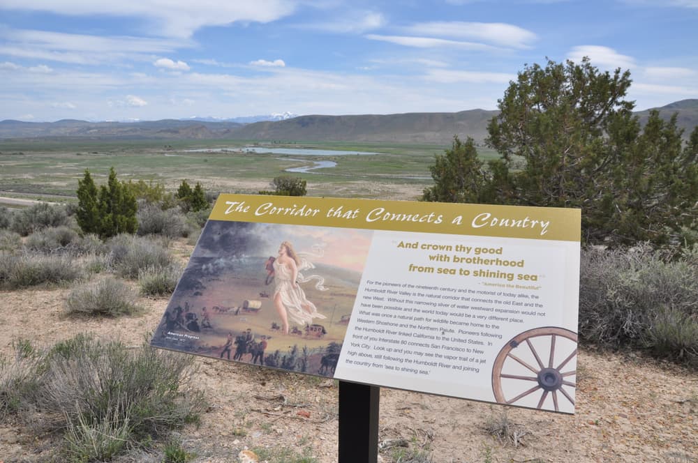
The California Trail Back Country Byway parallels a portion of the California National Historic Trail, which saw over 250,000 immigrants make their way from Independence, Missouri to California over 150 years ago. More than 1,000 miles of trail ruts and traces can still be seen across 10 states along this historic trail. In 1849, gold was discovered at Sutter's Fort near Sacramento, California, setting off a rush by miners and others seeking free land in California. By 1869, more than a quarter of a million people crossed the plains and mountains heading to the West to find gold and claim free land. The California Trail offered several paths to the West Coast and California. Across Nevada, travelers followed along the Humboldt River to the Fortymile Desert and  ascend the Truckee River. Eventually they ascended the Sierras via Emigrant Gap and stumbled down to Sutter’s Fort. By the 1860s, freight and mail companies, military expeditions, new settlements and trading stations, and thousands of travelers headed in all directions had transformed the California Trail into a road. But, in 1869, the Union Pacific Railroad was connected with the Central Pacific Railroad at Promontory Point in northern Utah, making it possible to travel across the nation by rail ushering in a new era in transportation and heralding the end of long-distance travel by wagon through the West.

Access the byway from Jackpot, Wells or Idaho. From north of Wells turn at Wilkins Montello rd towards Thousand Springs, a favorite watering hole of the immigrants that passed through the area. Enjoy primitive camping, hiking, backpacking, and mountain biking on BLM lands. Whatever you do, you’re sure to enjoy your experience as you travel a priceless piece of history on the California Trail Back Country Byway. Allow 3+ hours to enjoy these 96 miles.

Other Information

Nevada's Back Country Byways are designed for overlanding and 4WD high clearance passenger car travel. Routes should be maintened by county and BLM partners but there may be instances where roads are washed out or impassible. Always have a backup plan and travel with extra safety resources such as food, water, and spare tire. 

Gas and other services are limited in this area. See Trailside Services before heading out to plan accordingly. 

Dive deeper into the history of the California Trail and visit the California Trail Interpretive Center in Elko. 

Be part of the National Historic Trails Passport program and visit all ofthe national historic trails across the US!

Plan your visit along I-80 by visiting these cultural and historic landmarks. 

Trail Manager

For more informaiton vist the BLM Back Country Byway website or contact: 

Bureau of Land Management - Elko District Office

Bureau of Land Management - Elko District Office
BLM Elko District Office
3900 Idaho Street
Elko, Nevada 89801
Phone: 775-753-0200
BLM_NV_ELDOwebmail@blm.gov
View website

Download

Download map files for your own use.

Working with Downloaded Files

Recreate Responsibly

Be Considerate of Other Visitors
Consider volunteering with a trails organization to give back to the trails that give you so much!
Legend
|
Hide All

Trailhead Information

Navigating the Byway: 
Start 26 miles north of Wells off US 93 or through Jackpot, Nevada along US 93.

From Wells: 

  • Follow north along US Highway 93 for 26 miles
  • Turn right at Wilkins Montello Rd. (Winecup Ranch Entrance) There will be a small brown BLM directional sign. 
  • Continue on the byway for 45 miles, where the byway divides.
  • Either continue north and end 2 miles south of Jackpot, NV, or take Elko County Road East and end in Oakley, Idaho.

From Jackpot:  

  • Enter the byway just south of Jackpot along Hwy 93 where you will see a small BLM directional sign for Goose Creek and Delaplain
  • Continue along this route until you intersect with Goose Creek Rd and the middle fo the old California Trail.  
  • From here, continue north to Idaho or South to Wells. 
    • Follow signs for Goose Creek while navigating this route. 


Click on a parking icon to get custom directions
Please Log In or Create Account to add comments.
Find businesses and organizations that are located around this trail that support adventuring outdoors!
Legend
Hide All
No services shown. Try zooming out.
Hang Tight!
Nearby services are loading
SHARE THIS TRAIL
PRINT THIS TRAIL

Add Trail Log

Please wait…
Facebook Instagram YouTube X
Join In on the Fun!
Log in or create an account below to unlock all the great features of Nevada Trail Finder: keep track of trails you want to do, preserve memories of trails you’ve done, earn badges, and more!
Your log in attempt was not successful. Please try again.
    Lost your password? Reset your password
    Don't yet have an account?
    There was an issue with your submission. Please try again.
      * Indicates required field
      Already have an account? Login here
      Enter your username, and we will send you a new, randomly generated password to your email account.
      There was an issue with your submission. Please try again.

        Success! A new password has been emailed to you.

        Log in now

        Please wait…