Spring has sprung in Nevada! Discover the best places to view wildflowers here!

Eureka Mountain Bike Trail System

Rebuilt after fires and floods, Eureka has maintained its ranking as one of the best-preserved historical towns in Nevada, and offers 54 miles of trails around its outskirts.
Trail Uses
Hiking Mountain biking Horseback riding
Location
Eureka County
Length
54.00 miles (Network)
Difficulty
Easiest, Easy, Moderate, Difficult
Town
Eureka
Surface
Dirt, Gravel/Crushed Stone, Rock/Ledge, Sand
Pets
Permitted
Fees
No

Description

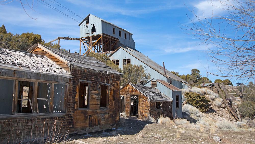
As you traverse through the mountains keep your eye out for remnants of old mine shafts and other historical sites such as old buildings and ranches. In the winter, Diamond Peak can be covered in snow, so check weather conditions before heading out. 

Prepare for lack of shade along routes by bringing plenty of water, wearing a hat and sunscreen, and long light layers.

OHV use is permitted throughout the city and on designated trails in the surrounding areas.

Check the map before heading out, some trails may cross over private property. Be sure to stick to BLM owned land areas. 

Other Information

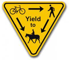
This is a multi-use trail system. Users may encounter other recreationalists such as mountain bikers, horseback riders, hikers and OHV users. Use the following graphic as a guide to know when to yield and to whom.

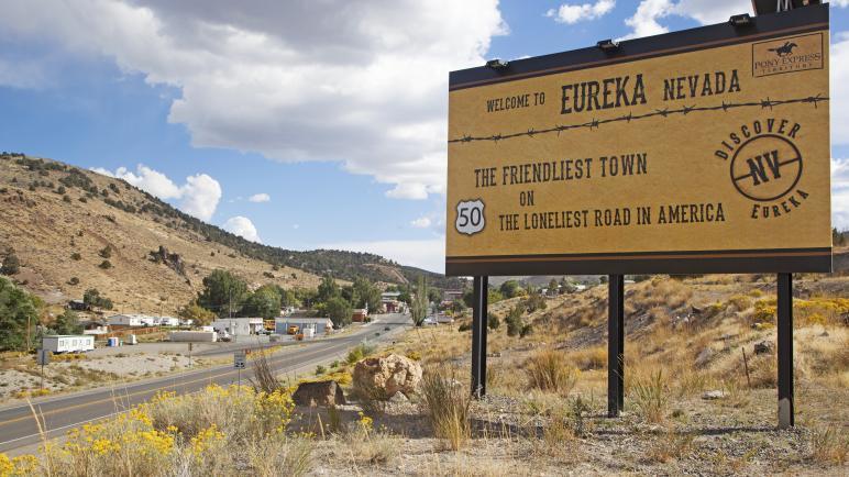
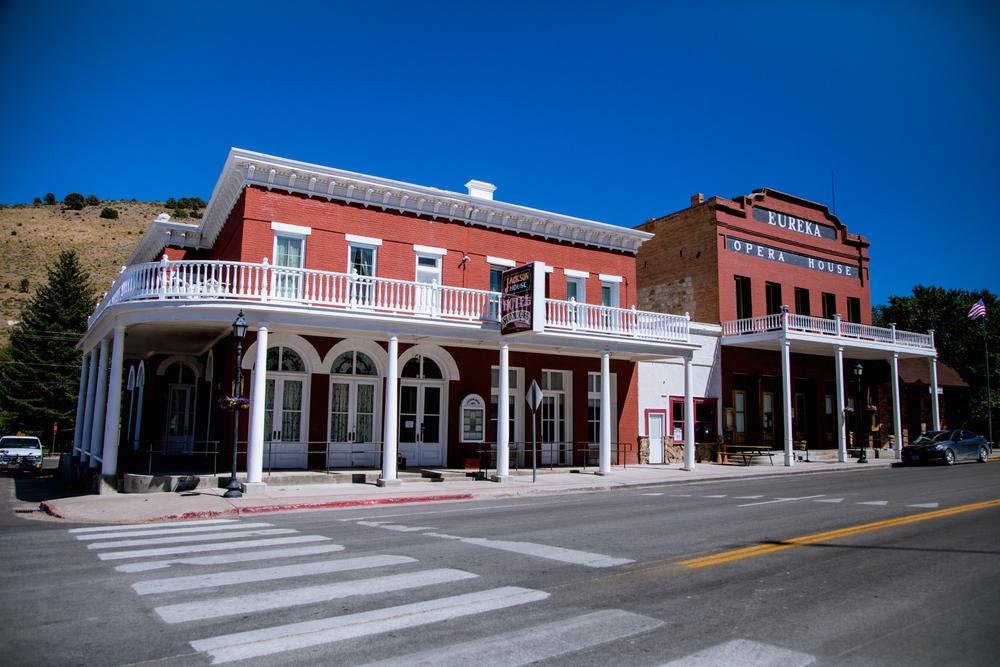
Along the Loneliest Road in America, US-50, Eureka has made itself known as one of the best-preserved historical mining towns in Nevada. To gain more tourist travel, several new trails have been designed and built just along the outskirts of the city. 

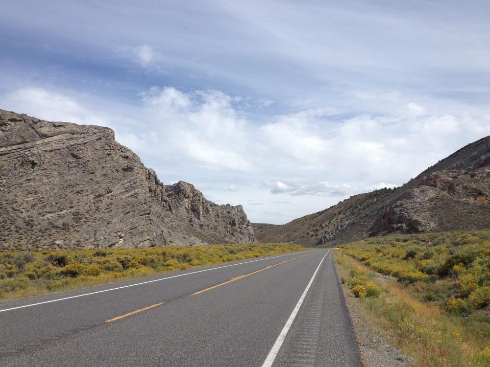
Eureka is situated in Diamond Valley, and is bordered by two mountain ranges, the Diamond Mountains and Fish Creek Range. These mountains make for great exploring and a beautiful scenery.

While you’re visiting Eureka, be sure to check the city website for tours, restaurants, vacation rentals and more!
TravelNevada Eureka
Food, Lodging and Points of Interest in Eureka

Trail Manager

For additional information, visit the Bureau of Land Management, Battle Mountain District or the Eureka Tourism website, or contact:

Bureau of Land Management - Battle Mountain District Office

Bureau of Land Management - Battle Mountain District Office
50 Bastian Rd
Battle Mountain, Nevada 89820
Phone: 775-635-4000
BLM_NV_BMDOwebmail@blm.gov
View website
Eureka Tourism
Dana Lee Fruend
PO Box 845
Eureka, NV 89316
Phone: (775) 230-2232
dana@visiteurekanevada.net
View website

Download

Download map files for your own use.

Working with Downloaded Files

Recreate Responsibly

Be Considerate of Other Visitors
Yield to pedestrians on multi-use trails. Warn others that you are passing from behind with a friendly "Excuse me" and a smile.
Legend
|
Hide All

Trailhead Information

Eureka sits on US-50, 70 miles east of Austin, and 78 miles west of Ely. Trailheads are located on Prospect Street, at the intersection of Hog Pen Canyon Road and Holly Road, the end of E McCoy Street, Wittenburg Street and along US-50. Many of these trails are dirt roads and easily accessible.

Click on a parking icon to get custom directions
Please Log In or Create Account to add comments.
mawbars
April 26, 2023
Love this trail!
SHARE THIS TRAIL
PRINT THIS TRAIL

Add Trail Log

Please wait…
Facebook Instagram Twitter YouTube
Join In on the Fun!
Log in or create an account below to unlock all the great features of Nevada Trail Finder: keep track of trails you want to do, preserve memories of trails you’ve done, earn badges, and more!
Your log in attempt was not successful. Please try again.
    Lost your password? Reset your password
    Don't yet have an account?
    There was an issue with your submission. Please try again.
      * Indicates required field
      Already have an account? Login here
      Enter your username, and we will send you a new, randomly generated password to your email account.
      There was an issue with your submission. Please try again.

        Success! A new password has been emailed to you.

        Log in now

        Please wait…