Spring has sprung in Nevada! Discover the best places to view wildflowers in bloom here!

Monkey Rock

Come see one of the most popular visited rocks in the Lake Tahoe Basin!
Trail Uses
Hiking
Location
Washoe County
Length
2.00 miles (Round Trip)
Difficulty
Moderate
Town
Incline Village
Surface
Dirt, Paved
Pets
Permitted
Fees
No

Description

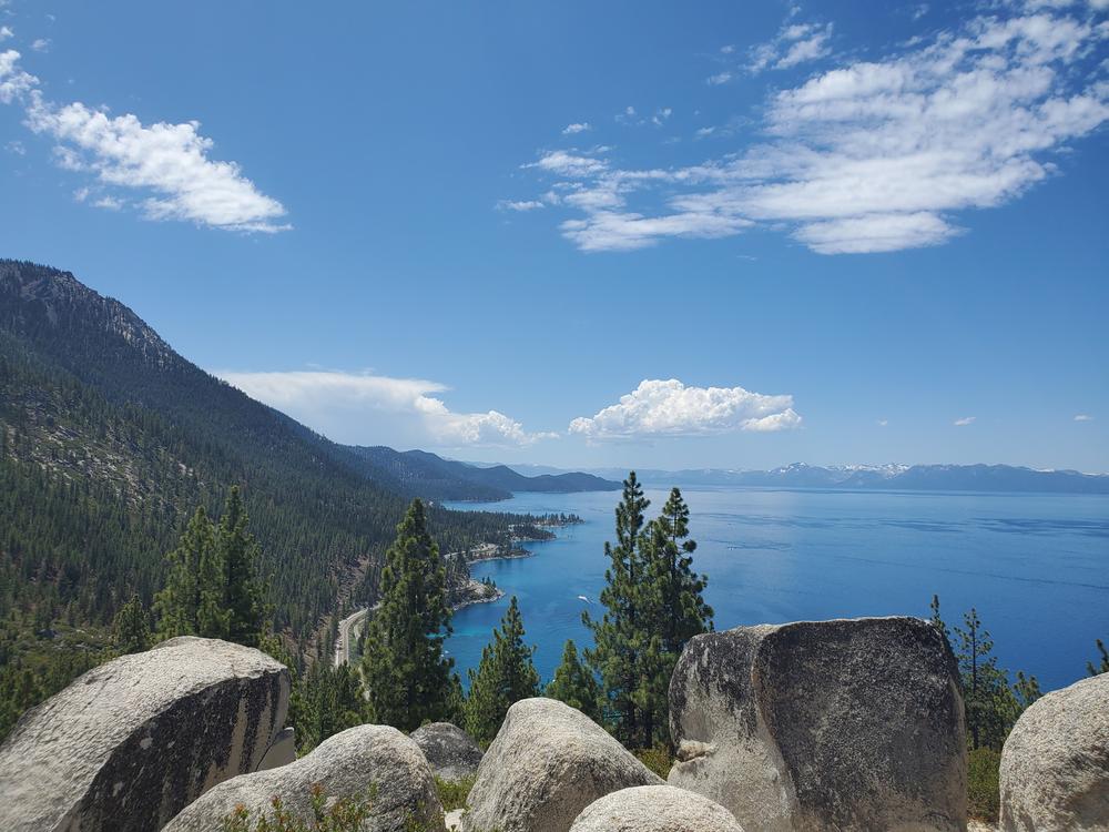
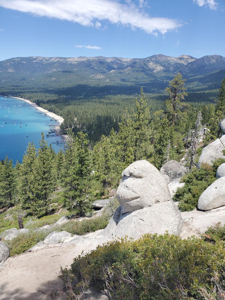
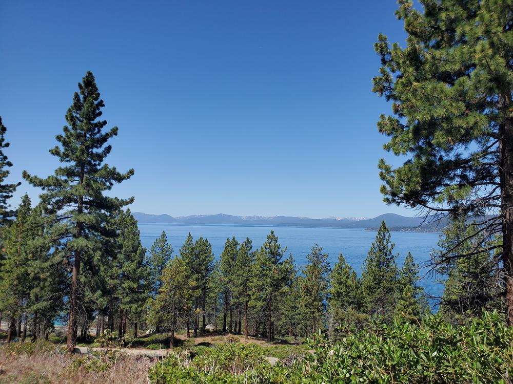
This is a very well maintained trail that follows along Tunnel Creek Rd. Continue along this road until you take the first spur trail to the left up to the summit. It is regularly traveled by people of all ages and skill levels. There is about 500 ft of elevation gain over one mile making this a moderately challenging hike! To make this hike a loop, you can connect to the hidden beach trail that heads towards the lake and connects to the East Shore trail. During the summer months, this trail is great to do around sunset as the trail is easy to follow and you have stunning views of the lake from the top.

Grab lunch at the Tunnel Creek Cafe or rent a bike at the Flume Trail Bikes right behind the cafe!

Other Information

Paid parking is available in front of Tunnel Creek Cafe. Parking at this lot is free after 7 pm. 

For events, places to stay and other activities in north Lake Tahoe visit their website. For more activities and lodging in South Lake Tahoe, visit their website!

Trail Manager

For more information visit the Lake Tahoe Basin Management Unit website or contact: 

USFS - Lake Tahoe Basin Management Unit

USFS - Lake Tahoe Basin Management Unit
35 College Drive

South Lake Tahoe , California 96150
Phone: (530) 543-2600
View website

Download

Download map files for your own use.

Working with Downloaded Files

Recreate Responsibly

Dispose of Waste Properly
Dispose of solid human waste in a cathole 6-8 inches deep and at least 200 feet from water, camp, or trails. Don't forget to cover it up when you're done!
Legend
|
Hide All

Trailhead Information

Trail access is located behind Tunnel Creek Cafe, along Tunnel Creek rd. 

Click on a parking icon to get custom directions
Please Log In or Create Account to add comments.
These awesome businesses support our goal of connecting people to outdoor adventures!
Hang Tight!
Nearby services are loading
No Results
No Services Found

Trail Alerts

Safety
Be BearWise
March 1 – November 11

Bear activity is high in this area. Keep (people) (pets) (property) safe. Keep bears wild. For more information on the BearWise campaign, visit the Recreate Responsibly page, or click on this link to learn how to be BearWise in the outdoors. 

SHARE THIS TRAIL
PRINT THIS TRAIL

Add Trail Log

Please wait…
Facebook Instagram YouTube X
Join In on the Fun!
Log in or create an account below to unlock all the great features of Nevada Trail Finder: keep track of trails you want to do, preserve memories of trails you’ve done, earn badges, and more!
Your log in attempt was not successful. Please try again.
    Lost your password? Reset your password
    Don't yet have an account?
    There was an issue with your submission. Please try again.
      * Indicates required field
      Already have an account? Login here
      Enter your username, and we will send you a new, randomly generated password to your email account.
      There was an issue with your submission. Please try again.

        Success! A new password has been emailed to you.

        Log in now

        Please wait…