The change of the season is upon us in Nevada. Visit 3  fall foliage locations between now and November 30th to get your leaf peeper badge!

Tahoe Rim Trail

The Tahoe Rim Trail (TRT) provides 165 miles of single-track trails that circumnavigate Lake Tahoe, while passing through two states, six counties, one state park, three national forests, and a number of wilderness areas.
Trail Uses
Walking Hiking Mountain biking E-biking Horseback riding Cross-country skiing
Location
Alpine County (CA), Carson City, Douglas County, El Dorado County (CA), Placer County (CA), Washoe County
Length
165.00 miles (Loop)
Difficulty
Moderate, Difficult, Expert
Towns
Emerald Bay (CA), Incline Village, Kingsbury, Tahoe City (CA)
Surface
Dirt, Gravel/Crushed Stone, Paved, Rock/Ledge, Sand
Pets
Permitted on Leash
Fees
No
License Required
No
Wilderness Areas
Mt. Rose Wilderness Area

Description

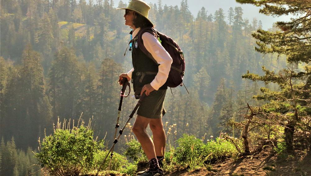
Whether walking a short distance from the trailhead, or hiking longer distances, exploring the Tahoe Rim Trail (TRT) is a great way to get out and see wildflowers, fungi, or fall colors. The trail can be divided up into eight segments, ranging from 12.2 - 32.5 miles in length. Unofficial entry points also provide a means of getting onto the trails. 

Tahoe City to Brockway Summit (20.2 miles)
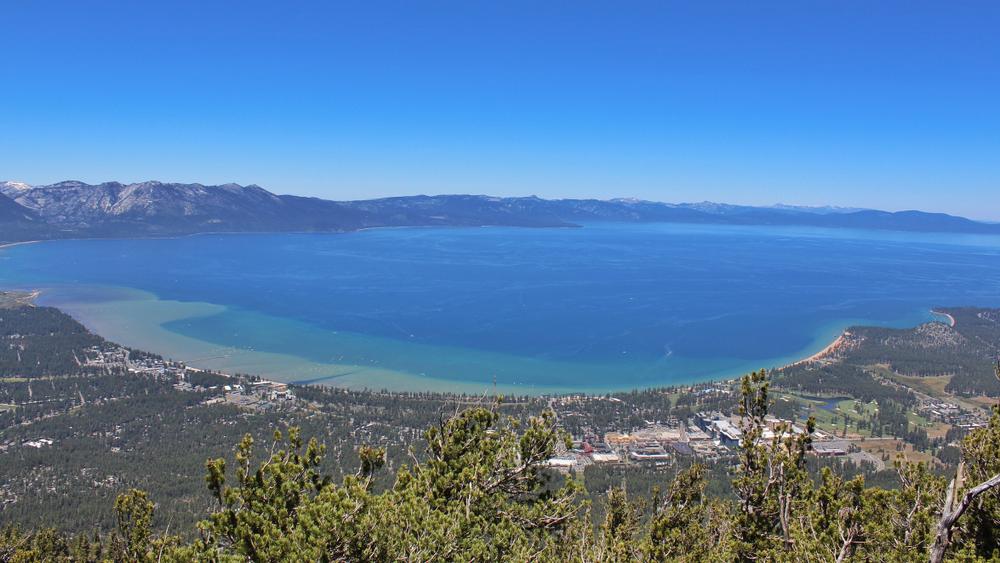
This segment of trail begins by meandering through groves of fir and cedar trees and across open hillsides covered with manzanita. It is a steep climb up until about half way when the trail begins to plateau. Where the trail plateaus there is a nice view of Lake Tahoe, and there is shade most of the way until the drop down into Watson Lake. Between Watson Lake and Brockway the trail gently winds through low sloping hills covered in meadows and thick forest.

Brockway Summit to Mount Rose Summit / Tahoe Meadows (20.2 miles)
This segment of the trail is most prized due to its vast meadows of wildflowers, towering waterfalls, and for having the highest peak along the TRT trail, Relay Peak. Along this segment are beautiful views of Lake Tahoe and the Sierra and Carson range. Several smaller spur trails offer sides adventures, including one that leads to Mount Houghton. 

This segment of trail may be quite populated because it passes through Tahoe meadows, the Marlette Flume trail and Spooner Lake. 3 improves campsites are located long this segment, one at Hobart Reservoir, Marlette Lake and North Canyon Rd. Although it may be crowded at times, this segment should not be passed up due to its rich history, multiple peaks and of course, stunning views.
 
This trail segment has a few switchbacks that wind through beautiful granite outcrops, Jeffery pines, ancient firs and aspen groves. Plenty of wildlife inhabit this are from coyotes, mule deer and marmots. One you pass Spooner Summit the trail the trail has a series of ascents and descents. The tallest peak of this segment is Genoa Peak at 9,150 feet that overlooks the beautiful Carson Valley. 
 
The trail begins by following the ridge of the Carson Range and traverses through thin and thick forest outcrops with sprinklings of alpine meadows throughout. Camping and fishing is available at Star Lake making this a great place to set up camp for the night or take a nice dip to cool off. This lake is nestled at the base of Jobs Peak, Job’s Sister and Freel Peak. The more rugged part of this segment weaves through old growth junipers and across granite passes with beautiful views of the Sierras and Lake Tahoe. This segment comes to a steady descent as you approach the Big Meadow Trailhead. 
 
Along this section the trail passes along several creeks, lakes and alpine forests. The middle part of this segment connects with the Pacific Crest Trail before weaving through rolling landscaped of meadow. The northern end of this trail is the most rugged and dry while opening up occasionally to views of Lake Tahoe. 
 
The longest segment of the TRT drops through the heart of Desolation Wilderness. Large segments of smooth granite take over with some pines and firs sprouting through. Camping and swimming is available at Lake Aloha. 
 
The shortest segment of the TRT emerges from flowery meadows and swoops around volcanic peaks. Near Twin Peaks, the TRT splits form the Pacific Crest Trail (PCT), head east to stay on the PCT. Several meadows, patches of thick forest, creeks and waterfalls guide you back to Tahoe City. Plenty of spur trails line the trail allowing for more side adventures and lead to several improved campsites. 
 

Trail conditions are best during the usually snow-free months of July through mid-October, and the height of the wildflower bloom is usually mid-July to mid-August.

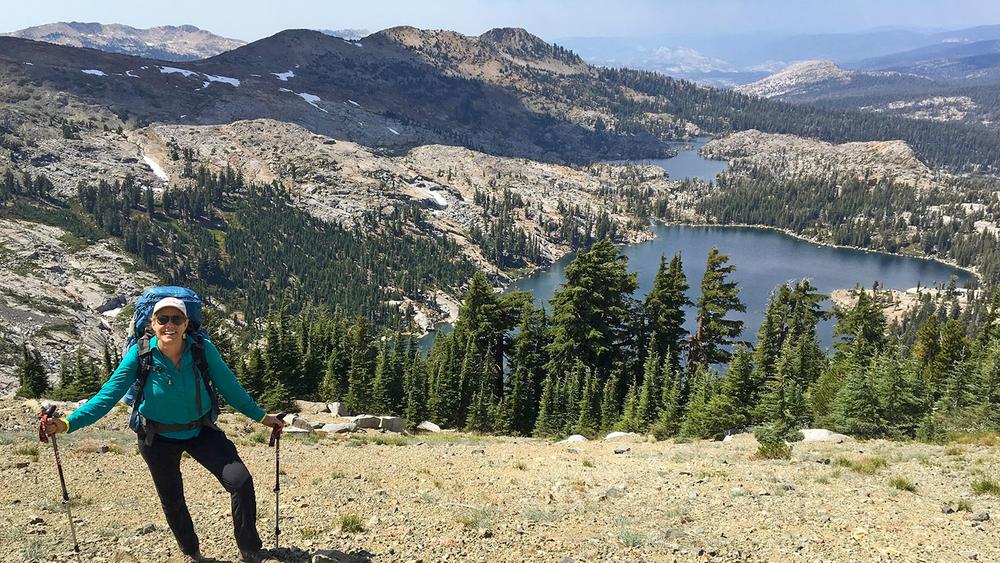
Not yet ready to hike the entire trail? No worries! There are several day hikes that are just as beautiful as the Tahoe Rim Trail. These trails are sure to prepare you for the entire rim trail. Visit some beautiful alpine lakes, wildflower meadows, peaks or waterfalls in just a days hike! These day hikes range from easy two-mile hikes to more strenuous 12 mile out-and- back trails that are sure to leave you wanting more. 

Other Information

More information such as current conditions and guided hikes is available at Tahoe Rim Trail Association

Plenty of lodging and services available in nearby cities such as Stateline, Kingsbury, Incline Village, Kings Beach and Tahoe city. 

Check out Visit Lake Tahoe for some more popular activities and endless fun around the lake!

Permit required for overnight stays in Desolation Wilderness. Visit Recreation.gov to book your permit.

Trail Manager

For additional information, visit the USFS - Lake Tahoe Basin website or the Tahoe Rim Trail Association website or contact:

US Forest Service - Lake Tahoe Basin

US Forest Service - Lake Tahoe Basin
35 College Drive
So. Lake Tahoe, California 96150
Phone: (530) 543-2600
sm.fs.paltbmu@usda.gov
View website

Tahoe Rim Trail Association

Tahoe Rim Trail Association
PO Box 3267
Stateline, NV 89449
Phone: (775) 298-4485
info@tahoerimtrail.org
View website

US Forest Service - Carson Ranger District

US Forest Service - Carson Ranger District
1536 South Carson Street
Carson City, NV 89701
Phone: (775) 882-2766
View website

Download

Download map files for your own use.

Working with Downloaded Files

Recreate Responsibly

Plan Ahead and Prepare
Tell someone your plan and when you’ll return, just in case.
Legend
|
Hide All

Trailhead Information

There are 12 official trailheads, easily reached by vehicle, that provide access to the eight trail segments that form a continuous loop in the mountains above the lake.

There is major trail access from:

  • Tahoe Meadows
  • Mount Rose summit 
  • Brockway Easy
  • Tahoe City North/Fairway Drive
  • 64 Acres
  • Barker Pass
  • Echo Lake
  • Echo Summit
  • Big Meadow
  • Kingsbury South 
  • Kingsbury North 
  • Spooner South 
Click on a parking icon to get custom directions
Please Log In or Create Account to add comments.

Trail Alerts

Safety
Be BearWise
March 1 – November 11

Bear activity is high in this area. Keep (people) (pets) (property) safe. Keep bears wild. For more information on the BearWise campaign, visit the Recreate Responsibly page, or click on this link to learn how to be BearWise in the outdoors. 

SHARE THIS TRAIL
PRINT THIS TRAIL

Add Trail Log

Please wait…
Facebook Instagram Twitter YouTube
Join In on the Fun!
Log in or create an account below to unlock all the great features of Nevada Trail Finder: keep track of trails you want to do, preserve memories of trails you’ve done, earn badges, and more!
Your log in attempt was not successful. Please try again.
    Lost your password? Reset your password
    Don't yet have an account?
    There was an issue with your submission. Please try again.
      * Indicates required field
      Already have an account? Login here
      Enter your username, and we will send you a new, randomly generated password to your email account.
      There was an issue with your submission. Please try again.

        Success! A new password has been emailed to you.

        Log in now

        Please wait…